The 2012 route
One of the most important aspects of a ride like the WMLR is the planning of the route and the job gets harder with every ride. Obviously, the route must take into consideration several important factors: the total distance for each leg, the range of the bikes and availability of fuel stations within the bike with the smallest range, the availability of reasonable accommodation and security at the destination locations among others.
Another important factor to consider is the overall uniqueness of the locations. It is very important for me that people see new places in each ride so I do my best not to duplicate destinations. However, in many cases, some locations will have to be duplicated. As usual, I try to avoid the major expressways as much as possible so we are riding on the roads less traveled (so to speak). So with all of that in mind, the route for this WMLR2012 is now confirmed.

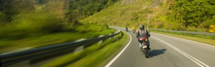
The planned route will take us in a loop around the West Malaysian peninsular. We will be riding along both coasts (the east and the west) and borders (the north and the south). We will be riding on some of the best roads available in West Malaysia and across the deepest mountain range that runs along the centre of the peninsular. We will be visiting some of the less known places as well. All in all, this looks like a very promising route indeed!
The destinations in this route includes Kuala Selangor, Pulau Pinang, Kota Bahru, Temerloh and Tanjung Sedili. We will also be making stops in many places along and around the route and destinations. I am sure that some of these places sound foreign to you and that is precisely why we will be visiting them.
Do leave a comment if you know of interesting places that is not too far from the route. Who knows, the place you recommend might end up being the one that we all remember!
In the meantime, keep checking back and experience the route and destinations through our eyes. It promises to be a journey to remember!

Now I saw the route map. Ok this dem good. I will try once you people return .
after analysis map,
I noticed you try to touch narathiwat for the sake of touching the most north east tip. To do that I recommend to enter gua musang and go narathiwat. Actually this district belongs to Siam. U either get to Pengkalan Kubur border or sg. golok border. Also after getting to the tip u can also go Gerik and enter Betong, Siam and overnight then from Betong to hadyai. Then overnight Hadyai and return to Bukit Kayu hitam and use trunk road to penang island.
The most awaiting path will be in Pahang centre backbone @ Trans Titiwangsa – Penisula Msia backbone. And Perak coastal trunk roads.
Why u going to Tanjung sedili ? I have been there. That is the place ppl go for Sibu Island jetty. There got some chalets and on the way got Caltex and palm oil factories.
We are not going to Thailand.
Pingback: WMLR – Gateway to Adventure « West Malaysia loop ride
Hiya very cool site!! Man .. Excellent .. Amazing ..
I will bookmark your website and take the feeds additionally?
I’m glad to seek out so many helpful information here in
the submit, we want work out extra strategies on this regard, thanks for sharing.
. . . . .